Current Locations
2016 / 2-week projectCATEGORIES: interaction, speculative
KEYWORDS: Google Maps, GPS, location services, simulation
I used Unity to create an interactive simulation that visualizes how the position of GPS satellites can affect the “margin of error” around your current location.
What if the way you are represented on a digital navigation interface was also reflected in the physical world?
PROJECT OVERVIEW
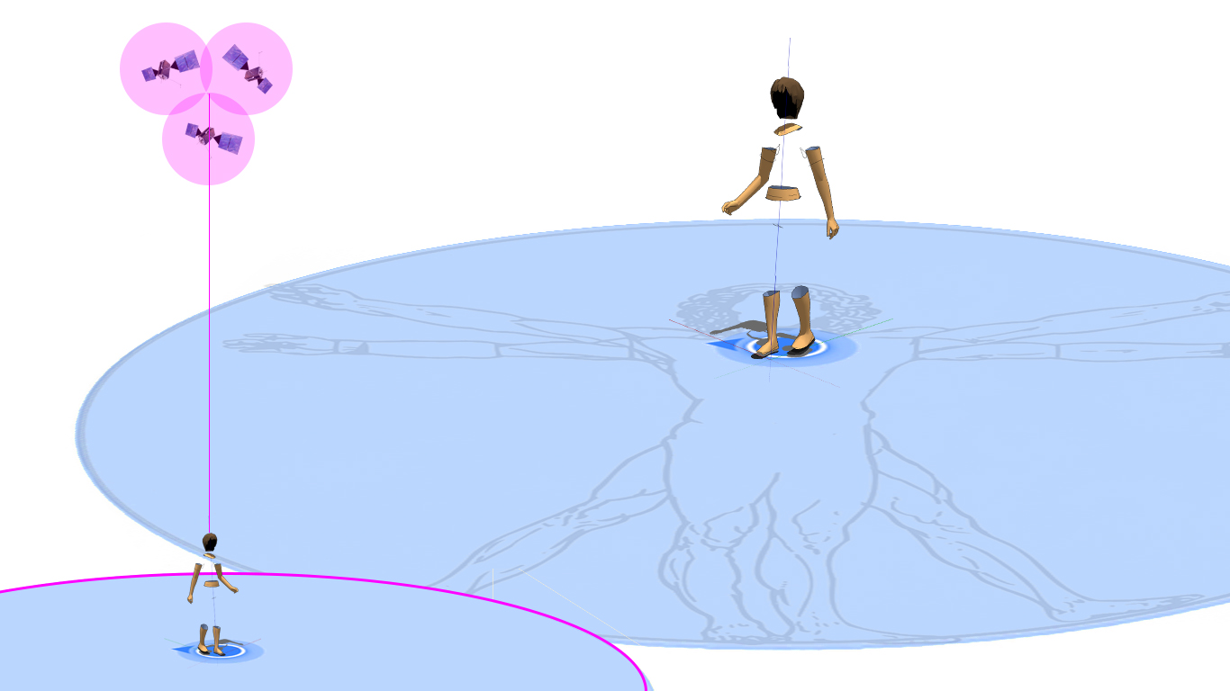
If you pull out your phone and open Google Maps, you see a blue dot—that blue dot represents your location. But the ring around that blue dot is a margin of error: according to the 24 GPS satellites in orbit, you could be in any of those locations.
What if your physical location was also shattered into this radius? How would this affect how you relate to the physically and digitally networked spaces you inhabit?
PROJECT OUTCOMES
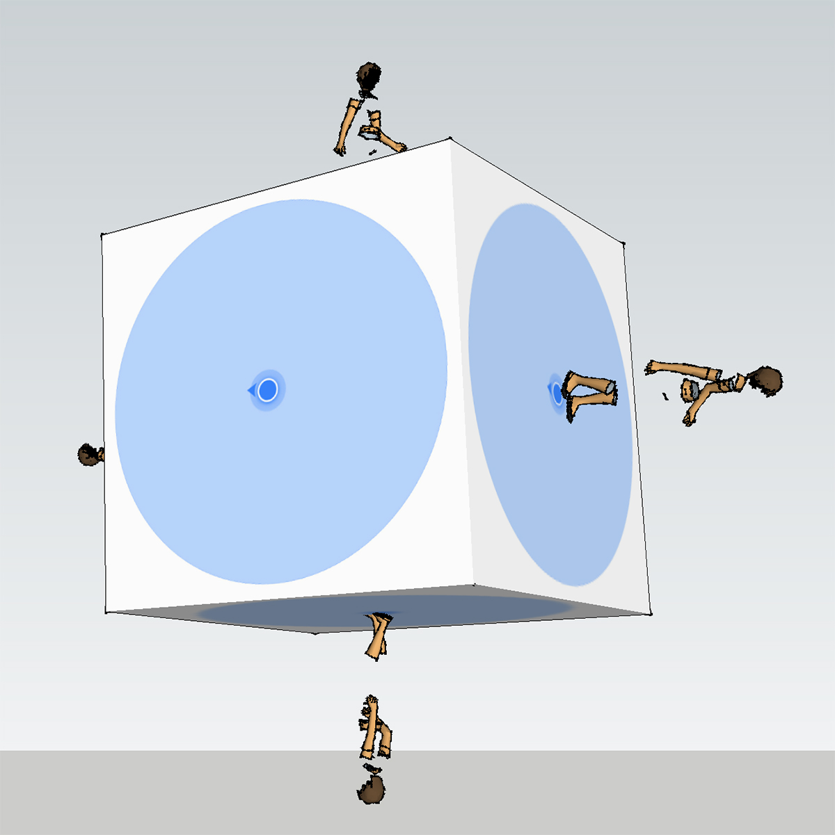
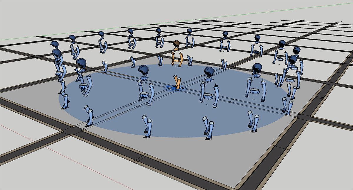
My simulation situates the user in a familiar interface made unfamiliar: tracking your current location on a digital interface. The movement of the figure in the simulation is triggered by user input, using arrow keys to move through an unmarked terrain.
PROCESS
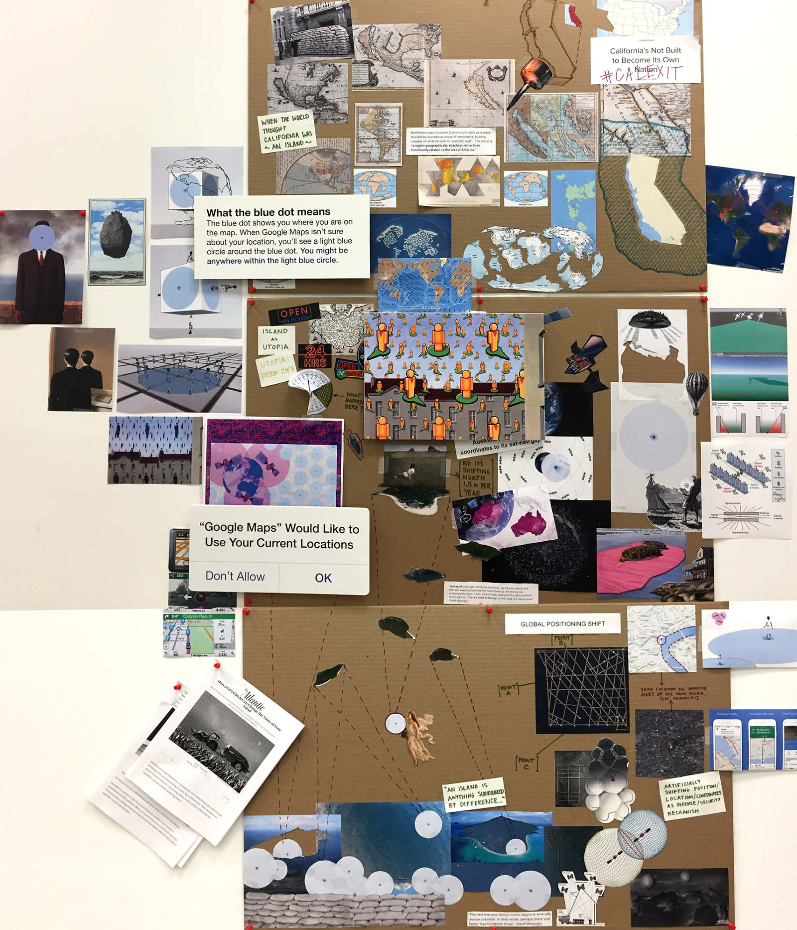
Phase 01: VISUAL RESEARCH WALL
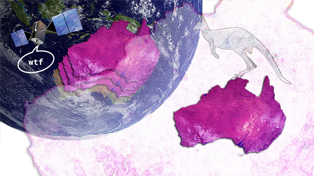
My research for this simulation started with my existing interest in two tipping points: GPS dependency and islands movements. By building up my research in a visual collage wall, I was able to draw connections between the indeterminacy of GPS-determined locations and the renegotiations of boundaries and extents that island forms must face.
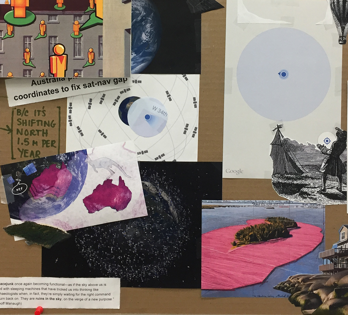
↳ Detail of visual research wall. Margin of error around blue location dot juxtaposed with Surrounded Islands by Christo and Jeanne-Claude.
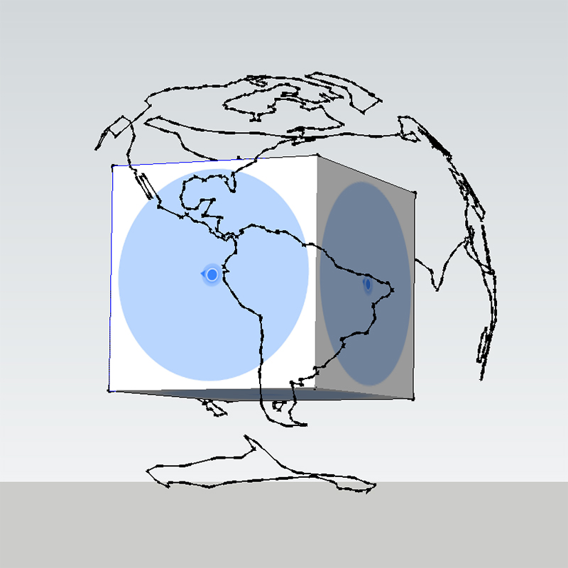
↳ Early simulation test in Unity.
Phase 02: TECHNICAL PROTOTYPING
As I started to get my footing in Unity, I reduced my working scenario to as few components as possible: GPS satellites moving around an individual in an indeterminate space. In my early Unity sketches, I was drawn to the idea of a GPS satellites casting a shadow on the person who is receiving its signal (or a GPS satellite seeing its own shadow) as well as the "shattering" of an individual into every possible position in their location radius.

↳ Concept collages and reference imagery.
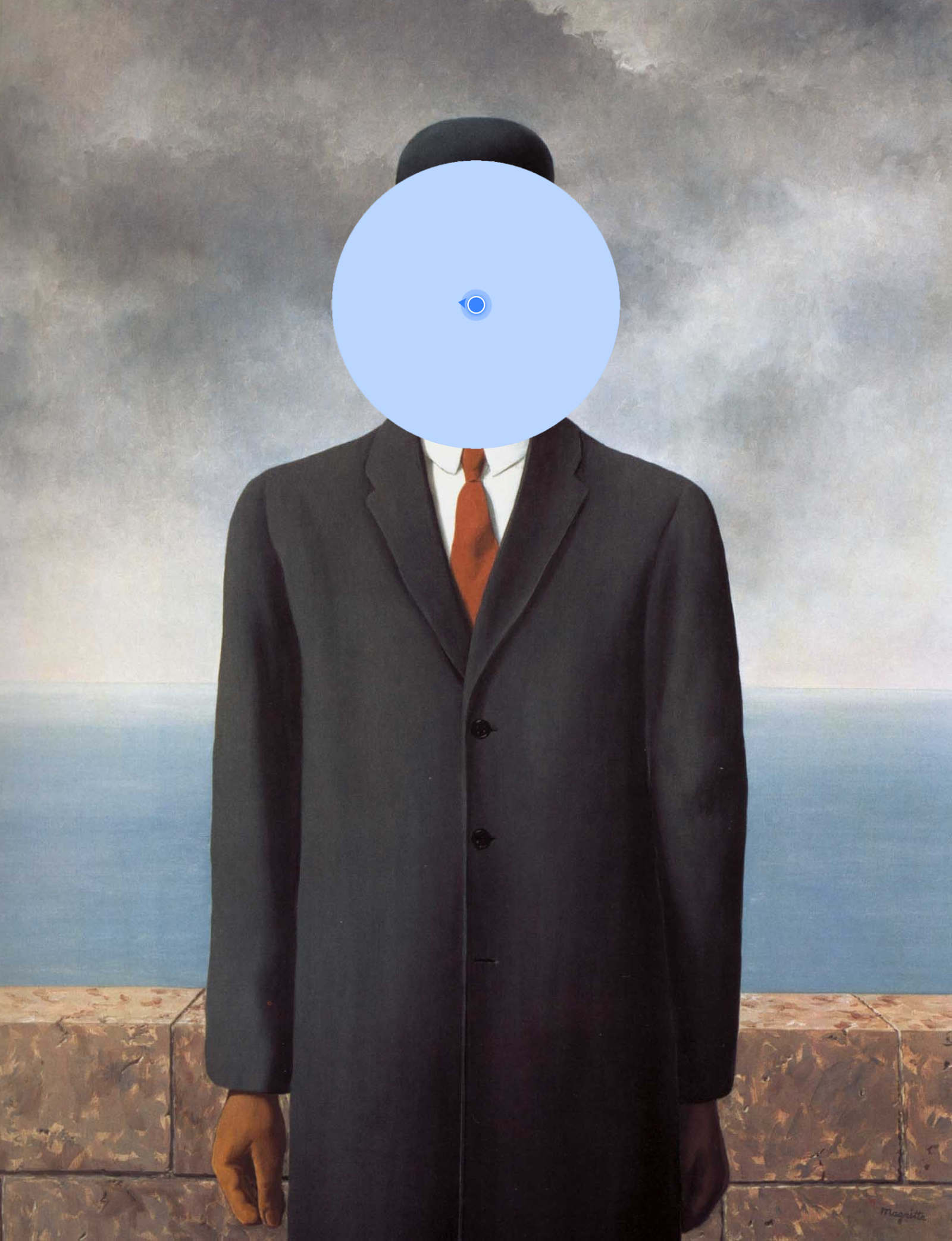
Phase 03: LOOK & FEEL
As I worked to get the individual components of my final simulation working independently, I knew couldn't wait until I had everything in Unity working before I made my aesthetic decisions. Parallel to technically tackling Unity, I composed a number of collages to work my concept back into a working aesthetic context. My aesthetic choices were strongly influenced by the blue "current location" dot of Google Maps and by the surrealist imagery of René Magritte.